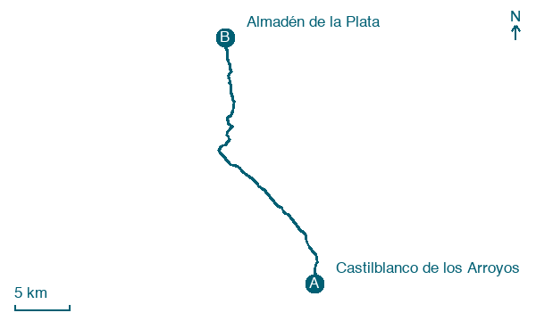
Castilblanco de los Arroyos → Almadén de la Plata
Walking distance 28.2 km
Download Appy for the stage map
Stage information
- Ascent
- 839 m
- Descent
- 710 m
Difficulty: challenging (estimated)
Walking the stage
Cover 28 km from Castilblanco de los Arroyos to Almadén de la Plata, with 839 m of climbing to earn.
On arrival in Almadén de la Plata, consider a stop at Castillo, close to the finish.
What to see on this stage
History and landmarks
Castillo
Castle · < 100 m from the trail as the crow flies
Castle. Castle, in Almadén de la Plata, Spain, designated as cultural heritage.
Fuente del Reloj
< 100 m from the trail as the crow flies
Nature and landscape
Cerro de las Tejoneras
Summit · 1.3 km from the trail as the crow flies
Map · Castilblanco de los Arroyos → Almadén de la Plata
Take your walk with you: download Appy
Via de la Plata: Castilblanco de los Arroyos → Almadén de la Plata. Explore maps, stages and elevation in the app, and plan your train or bus journey.

