Poggio Bustone → Piediluco
Walking distance 22 km
Download Appy for the stage map
Stage information
- Ascent
- 748 m
- Descent
- 1178 m
Difficulty: moderate
Walking the stage
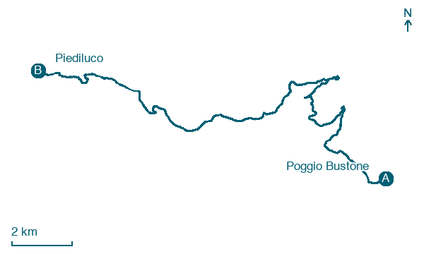
Climb 748 m over 22 km from Poggio Bustone to Piediluco, passing Rivodutri and Villa Giovannone.
On arrival in Piediluco, consider a stop at Platano occidentale di Piazza della Resistenza, Terni, close to the finish.
Look for these places on the stage map: Rivodutri, Cerqueto, La Macchie Alte, and Noceta.
What to see on this stage
History and landmarks
Monte Rosato
1.1 km from the trail as the crow flies
Monte Rosato is a peak of the Monti Reatini in Lazio, located in the municipality of Poggio Bustone (province of Rieti). The summit elevation is about 1510 m above sea level and the peak dominates the northeastern edge of the Piana Reatina.
Cima d'Arme
2 km from the trail as the crow flies
Cima d'Arme is a relief of the Monti Reatini located in Lazio, in the province of Rieti, in the municipality of Poggio Bustone.
Nature and landscape
Faggio di Cepparo, Rivodutri
Monumental tree · < 100 m from the trail as the crow flies
Italy’s monumental tree register identifies this specimen as Fagus sylvatica L. It records a height of 8.6 m and a trunk circumference of 290 cm.
Platano occidentale di Piazza della Resistenza, Terni
Monumental tree · < 100 m from the trail as the crow flies
Italy’s monumental tree register identifies this specimen as Platanus occidentalis L. It records a height of 32.5 m and a trunk circumference of 478 cm.
Map · Poggio Bustone → Piediluco
Take your walk with you: download Appy
Via di Francesco del Sud: Poggio Bustone → Piediluco. Explore maps, stages and elevation in the app, and plan your train or bus journey.

