Pontedeume → Betanzos
Walking distance 19.8 km
Download Appy for the stage map
Stage information
- Ascent
- 428 m
- Descent
- 421 m
Difficulty: moderate
Walking the stage
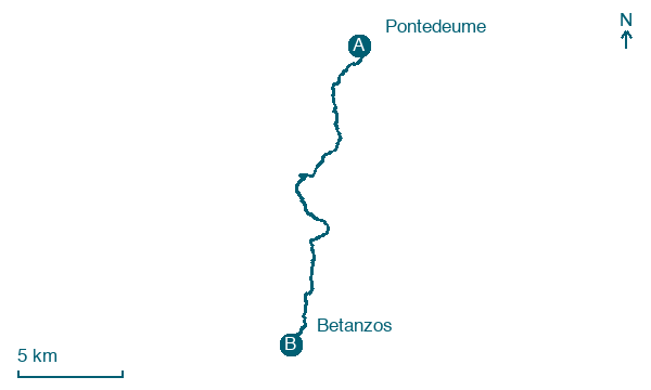
Climb 428 m over 20 km from Pontedeume to Betanzos, passing A Luqueira, A Prata and Montecelo.
On arrival in Betanzos, consider a stop at Museo das Mariñas, close to the finish.
Look for these places on the stage map: Cermuzo, A Prata, Porto de Abaixo, and O Barral.
What to see on this stage
History and landmarks
Igrexa de Santa María do Azougue
< 100 m from the trail as the crow flies
Monument, in Betanzos, Spain, designated as bien de interés cultural.
Museo das Mariñas
Museum · < 100 m from the trail as the crow flies
20th-century museum, in Betanzos, Spain, covering 2000.0 km².
Nature and landscape
Monte da Aguieira
Summit · 200 m from the trail as the crow flies
Club de Piragüismo Ría de Betanzos
300 m from the trail as the crow flies
Map · Pontedeume → Betanzos
Take your walk with you: download Appy
Camino Inglés (Ferrol): Pontedeume → Betanzos. Explore maps, stages and elevation in the app, and plan your train or bus journey.

