Mileto → Dinami
Walking distance 15.4 km
Download Appy for the stage map
Stage information
- Ascent
- 757 m
- Descent
- 1023 m
Difficulty: moderate
Walking the stage
Through olive groves and oak forests past the Marian sanctuary at Paravati and the medieval village of Dasà to inland Dinami.
Before leaving Mileto, locate Museo Nazionale di Mileto on the map. It is close to the starting point. On arrival in Dinami, consider a stop at Pioppo nero di Soreto, Dinami, close to the finish.
Look for these places on the stage map: San Giovanni.
What to see on this stage
History and landmarks
Museo Nazionale di Mileto
Museum · 100 m from the trail as the crow flies
Mileto Antica archaeological park
Archaeological site · 100 m from the trail as the crow flies
Nature and landscape
Pioppo nero di Soreto, Dinami
Monumental tree · 100 m from the trail as the crow flies
Italy’s monumental tree register identifies this specimen as Populus nigra L. It records a height of 14 m and a trunk circumference of 753 cm.
Map · Mileto → Dinami
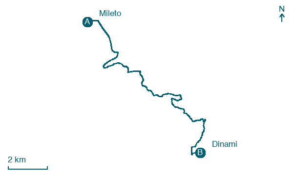
Take your walk with you: download Appy
Cammino del Normanno: Mileto → Dinami. Explore maps, stages and elevation in the app, and plan your train or bus journey.

