Castiglione d'Orcia → Vivo d'Orcia
Walking distance 16.6 km
Download Appy for the stage map
Stage information
- Ascent
- 813 m
- Descent
- 457 m
Difficulty: moderate
Walking the stage
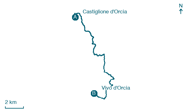
Climb 813 m over 17 km from Castiglione d'Orcia to Vivo d'Orcia, passing Campiglia d'Orcia, a full day on foot.
On arrival in Vivo d'Orcia, consider a stop at Ippocastano di Eremo - Vivo D'Orcia, Castiglione D'Orcia, close to the finish.
Look for these places on the stage map: Campiglia d'Orcia.
What to see on this stage
Nature and landscape
Acero campestre di Campiglia D'Orcia - Via Santa Maria, Castiglione D'Orcia
Monumental tree · < 100 m from the trail as the crow flies
Italy’s monumental tree register identifies this specimen as Acer campestre L. It records a height of 9 m and a trunk circumference of 250 cm.
Ippocastano di Eremo - Vivo D'Orcia, Castiglione D'Orcia
Monumental tree · 400 m from the trail as the crow flies
Italy’s monumental tree register identifies this specimen as Aesculus hippocastanum L. It records a height of 27 m and a trunk circumference of 330 cm.
Map · Castiglione d'Orcia → Vivo d'Orcia
Take your walk with you: download Appy
Romea Strata Italiana: Castiglione d'Orcia → Vivo d'Orcia. Explore maps, stages and elevation in the app, and plan your train or bus journey.

