Bolsena → Zepponami
Walking distance 16.5 km
Download Appy for the stage map
Stage information
- Ascent
- 520 m
- Descent
- 216 m
Difficulty: moderate
Walking the stage
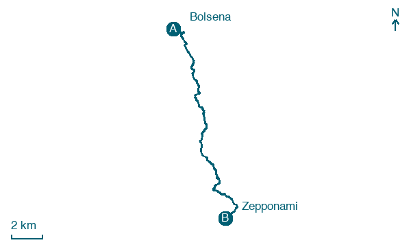
Follow a 16 km stage from Bolsena to Zepponami, with 520 m of climbing on the way, passing through Sant'Antonio and Le Coste.
Before leaving Bolsena, locate Necropolis and Cult Area of Poggio Pesce on the map. It is close to the starting point. On arrival in Zepponami, consider a stop at Colle Falisco, close to the finish.
Look for these places on the stage map: Podere Sailli, Sant'Antonio, Villa Serena (ex O.N.P.I.), and Le Coste.
What to see on this stage
History and landmarks
Colle Falisco
< 100 m from the trail as the crow flies
Colle Falisco is a hill in the Volsini mountains located in the municipality of Montefiascone in the province of Viterbo, offering a panoramic view of Lake Bolsena and the plain leading towards Viterbo.
Necropolis and Cult Area of Poggio Pesce
Archaeological site · 100 m from the trail as the crow flies
The archaeological area of Poggio Pesce consists of a core of necropolises, located both to the east and west of the small valley that divides the hill into two parts, and an area of rock worship.
Map · Bolsena → Zepponami
Take your walk with you: download Appy
Via Francigena: Bolsena → Zepponami. Explore maps, stages and elevation in the app, and plan your train or bus journey.

