Padula → Montesano sulla Marcellana
Walking distance 18.5 km
Download Appy for the stage map
Stage information
- Ascent
- 712 m
- Descent
- 538 m
Difficulty: moderate
Walking the stage
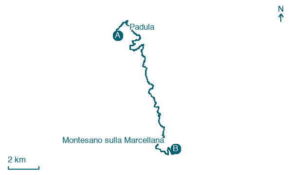
Walk 18 km from Padula to Montesano sulla Marcellana with 712 m of climbing, passing Arenabianca and Prato Comune.
Before leaving Padula, locate Civic Multimedia Museum on the map. It is close to the starting point.
Look for these places on the stage map: Arenabianca, Prato Comune, and Terme di Montesano.
What to see on this stage
History and landmarks
Cosilinum archaeological park
Archaeological site · < 100 m from the trail as the crow flies
Archaeological site, in Padula, Italy, designated as Italian national heritage.
Civic Multimedia Museum
Museum · < 100 m from the trail as the crow flies
Museum, in Padula, Italy, designated as Italian national heritage.
Nature and landscape
Tiglio nostrale di Convento di San Francesco, Padula
Monumental tree · 500 m from the trail as the crow flies
Italy’s monumental tree register identifies this specimen as Tilia platyphyllos Scop. It records a height of 10 m and a trunk circumference of 460 cm.
Map · Padula → Montesano sulla Marcellana
Take your walk with you: download Appy
Cammino del Negro: Padula → Montesano sulla Marcellana. Explore maps, stages and elevation in the app, and plan your train or bus journey.

