Rifugio Pelizzo → Masseris
Walking distance 12.7 km
Download Appy for the stage map
Stage information
- Ascent
- 148 m
- Descent
- 697 m
Difficulty: moderate
Walking the stage
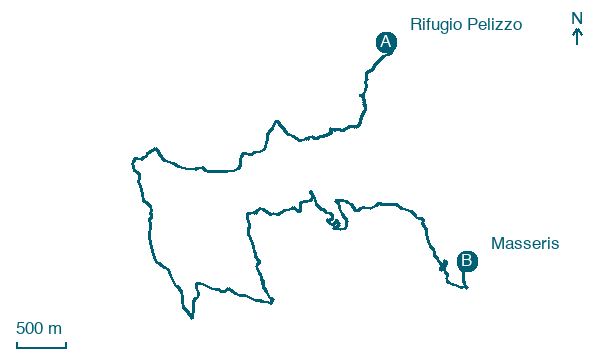
Follow an easy 13 km stretch from Rifugio Pelizzo to Masseris, passing Montemaggiore, Oballa and Sturam.
Look for these places on the stage map: Montemaggiore / Matajur, Oballa / Obali, Barza / Barca, and Stermizza / Starmica.
What to see on this stage
Nature and landscape
Faggio di Via Montemaggiore 70, Savogna
Monumental tree · < 100 m from the trail as the crow flies
Italy’s monumental tree register identifies this specimen as Fagus sylvatica L. It records a height of 29 m and a trunk circumference of 420 cm.
Carpino bianco di Ieronizza, Savogna
Monumental tree · 1.6 km from the trail as the crow flies
Italy’s monumental tree register identifies this specimen as Carpinus betulus L. It records a height of 18 m and a trunk circumference of 480 cm.
Map · Rifugio Pelizzo → Masseris
Take your walk with you: download Appy
Cammino delle 44 Chiesette Votive: Rifugio Pelizzo → Masseris. Explore maps, stages and elevation in the app, and plan your train or bus journey.

