Salvaterra → Trecenta
Walking distance 18.7 km
Download Appy for the stage map
Stage information
- Ascent
- 71 m
- Descent
- 72 m
Difficulty: easy
Walking the stage
Enjoy an easy 19 km walk from Salvaterra to Trecenta, with only 71 m of climbing, a full day on foot.
Before leaving Salvaterra, locate Museo civico Antonio Eugenio Baruffaldi on the map. It is close to the starting point.
What to see on this stage
History and landmarks
Museo civico Antonio Eugenio Baruffaldi
Museum · < 100 m from the trail as the crow flies
Palazzo degli Estensi
Palace · < 100 m from the trail as the crow flies
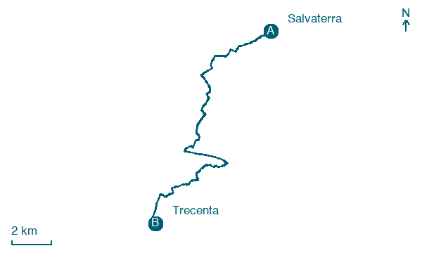
Map · Salvaterra → Trecenta
Take your walk with you: download Appy
Romea Strata Italiana: Salvaterra → Trecenta. Explore maps, stages and elevation in the app, and plan your train or bus journey.

