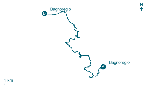
Bagnoregio → Bagnoregio
Walking distance 17 km
Download Appy for the stage map
Stage information
- Ascent
- 623 m
- Descent
- 510 m
Difficulty: moderate
Walking the stage
Walk a 17 km loop from Bagnoregio, passing Vetriolo and Civita di Bagnoregio, with 623 m of climbing.
Look for these places on the stage map: Vetriolo and Civita di Bagnoregio.
What to see on this stage
History and landmarks
Cistern, water infrastructure
Archaeological site · < 100 m from the trail as the crow flies
The structure consists of an underground chamber with a flat ceiling entirely carved into the rock, with a diameter of about 10 m and a height of 6 m. A significant portion of the structure was found collapsed.
Co-cathedral of Bagnoregio
Cathedral · 100 m from the trail as the crow flies
A town church raised to cathedral in 1699, after the earthquake of 1695 wrecked the old cathedral in Civita. Its altar facing the congregation is made from a pagan sarcophagus of the second century; the interior is a single nave with stucco decoration.
Map · Bagnoregio → Bagnoregio
Take your walk with you: download Appy
Via dei Tusci: Bagnoregio → Bagnoregio. Explore maps, stages and elevation in the app, and plan your train or bus journey.

