Sant'Agata sui Due Golfi → Punta Campanella
Walking distance 9.5 km
Download Appy for the stage map
Stage information
- Ascent
- 494 m
- Descent
- 688 m
Difficulty: easy (estimated)
Walking the stage
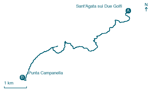
Walk 10 km from Sant'Agata sui Due Golfi to Punta Campanella, with 494 m of climbing along the way.
What to see on this stage
History and landmarks
Via Capo d'Arco
Bridge · 100 m from the trail as the crow flies
Via Fontana
Bridge · 100 m from the trail as the crow flies
Nature and landscape
Monte San Costanzo
< 100 m from the trail as the crow flies
Monte Santa Croce
100 m from the trail as the crow flies
Map · Sant'Agata sui Due Golfi → Punta Campanella
Take your walk with you: download Appy
Alta Via dei Monti Lattari: Sant'Agata sui Due Golfi → Punta Campanella. Explore maps, stages and elevation in the app, and plan your train or bus journey.

