Gornate Superiore → Castellanza
Walking distance 20.7 km
Download Appy for the stage map
Stage information
- Ascent
- 157 m
- Descent
- 226 m
Difficulty: moderate
Walking the stage
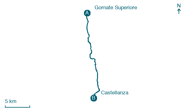
Walk 21 km from Gornate Superiore to Castellanza with 157 m of climbing, passing Biciccera and Cairate.
Look for these places on the stage map: Biciccera, Lonate Ceppino, Gorla Maggiore, and Olgiate Olona.
What to see on this stage
History and landmarks
Cascina Brughetto
1.5 km from the trail as the crow flies
Madonna dell'Albero
1.8 km from the trail as the crow flies
Nature and landscape
Platano comune di Via Montello 23, Olgiate Olona
Monumental tree · 200 m from the trail as the crow flies
Italy’s monumental tree register identifies this specimen as Platanus acerifolia (Aiton) Willd. It records a height of 38 m and a trunk circumference of 386 cm.
Cedro dell'Atlante di Via Luigia Greppi 4, Olgiate Olona
Monumental tree · 300 m from the trail as the crow flies
Italy’s monumental tree register identifies this specimen as Cedrus atlantica (Endl.) Manetti ex Carriere. It records a height of 30 m and a trunk circumference of 440 cm.
Map · Gornate Superiore → Castellanza
Take your walk with you: download Appy
Via Francisca del Lucomagno: Gornate Superiore → Castellanza. Explore maps, stages and elevation in the app, and plan your train or bus journey.

