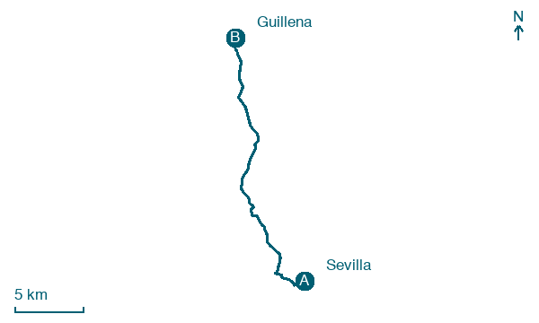
Sevilla → Guillena
Walking distance 22.8 km
Download Appy for the stage map
Stage information
- Ascent
- 29 m
- Descent
- 30 m
Difficulty: moderate (estimated)
Walking the stage
Leave Sevilla on a flat 23 km, passing Camas, Santiponce and La Algaba on the way to Guillena.
Before leaving Sevilla, locate Puente de Isabel II on the map. It is close to the starting point.
Look for these places on the stage map: Camas, Santiponce, La Algaba, and Torre de la Reina.
What to see on this stage
History and landmarks
Puente de Isabel II
Bridge · < 100 m from the trail as the crow flies
19th-century bridge, dedicated to Isabella II of Spain, in Seville, Spain, designated as bien de interés cultural, 149.0 km long.
Castillo de San Jorge de Sevilla
Castle · < 100 m from the trail as the crow flies
A medieval castle that served the Inquisition as headquarters and prison from 1481 to 1626, then was demolished in the 19th century. The Triana market now stands on it, with a museum in the ruins underneath.
Map · Sevilla → Guillena
Take your walk with you: download Appy
Via de la Plata: Sevilla → Guillena. Explore maps, stages and elevation in the app, and plan your train or bus journey.

