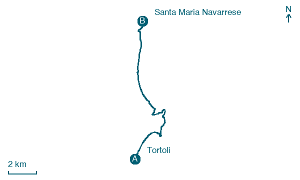
Tortolì → Santa Maria Navarrese
Walking distance 13.9 km
Download Appy for the stage map
Stage information
- Ascent
- 53 m
- Descent
- 28 m
Difficulty: easy
Walking the stage
Beach sand and paved streets through Arbatax lead past Torre di San Gemiliano, a round stone tower on a headland south of the port, with the Isola dell'Ogliastra visible ahead off Santa Maria Navarrese. The via begins its climb toward the hardest stretches of the ring.
On arrival in Santa Maria Navarrese, consider a stop at Carrubo di Santa Maria Navarrese - Piazza Principessa di Navarra, Baunei, close to the finish.
Look for these places on the stage map: Arbatassa/Arbatax and Lotzorai.
What to see on this stage
History and landmarks
Torre
Tower · < 100 m from the trail as the crow flies
The structure, originally built for lookout and immediate defense against sea attacks, is characterized by a slender truncated conical shape, standing 12 m tall and 7 m in diameter. Made of local granite elements, it features a vaulted room on the first floor accessible through a hatch.
Torre di San Gemiliano
Tower · < 100 m from the trail as the crow flies
A slender coastal watchtower from the early 1600s, a truncated cone 12 metres high and only 7 wide, with a tiny room inside. Built as a lookout against pirates, it sees 25 km out to sea and could signal the Barì tower.
Nature and landscape
Carrubo di Santa Maria Navarrese - Piazza Principessa di Navarra, Baunei
Monumental tree · < 100 m from the trail as the crow flies
Italy’s monumental tree register identifies this specimen as Ceratonia siliqua L. It records a height of 8.6 m and a trunk circumference of 332 cm.
Olivastro di Santa Maria Navarrese - Piazza Principessa di Navarra, Baunei
Monumental tree · < 100 m from the trail as the crow flies
Italy’s monumental tree register identifies this specimen as Olea europaea subsp. oleaster (Hoffmanns. & Link). It records a height of 10 m and a trunk circumference of 905 cm.
Map · Tortolì → Santa Maria Navarrese
Take your walk with you: download Appy
Cammino 100 Torri: Via Ogliastra: Tortolì → Santa Maria Navarrese. Explore maps, stages and elevation in the app, and plan your train or bus journey.

