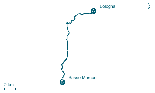
Bologna → Sasso Marconi
Walking distance 20.3 km
Download Appy for the stage map
Stage information
- Ascent
- 546 m
- Descent
- 311 m
Difficulty: moderate
Walking the stage
Head from Bologna to Sasso Marconi over 20 km, passing Madonna di San Luca and Montalbano, with 546 m of ascent.
Before leaving Bologna, locate Palazzo Bonasoni, Bologna on the map. It is close to the starting point.
Look for these places on the stage map: Madonna di San Luca, Monte Pradone, Le Ganzole, and Molinello.
What to see on this stage
History and landmarks
Palazzo Bonasoni, Bologna
Palace · 400 m from the trail as the crow flies
Portico di San Luca
< 100 m from the trail as the crow flies
Nature and landscape
La Rocca
Summit · 2 km from the trail as the crow flies
A small hill of 476 metres whose vertical sandstone walls are Bologna's classic climbing crag: more than 180 routes from 3b to 8a+ and a CAI via ferrata. Climbers dug and fitted the rock themselves.
Cedro dell'Atlante di Villa delle Rose - Via Saragozza 228/230, Bologna
Monumental tree · < 100 m from the trail as the crow flies
Italy’s monumental tree register identifies this specimen as Cedrus atlantica (Endl.) Manetti ex Carriere. It records a height of 32 m and a trunk circumference of 545 cm.
Map · Bologna → Sasso Marconi
Take your walk with you: download Appy
Via Degli dei: Bologna → Sasso Marconi. Explore maps, stages and elevation in the app, and plan your train or bus journey.

