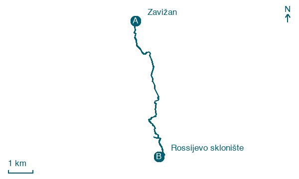
Zavižan → Rossijevo sklonište
Walking distance 7.6 km
Download Appy for the stage map
Stage information
- Ascent
- 447 m
- Descent
- 330 m
Difficulty: moderate
Walking the stage
Climb from Zavižan to Rossijevo sklonište, 8 km with 447 m of ascent, passing Lubenovac on the way.
On arrival in Rossijevo sklonište, consider a stop at Rožanski kukovi, close to the finish.
Look for these places on the stage map: Lubenovac.
What to see on this stage
Nature and landscape
Veliki Zavižan
Summit · 400 m from the trail as the crow flies
A 1,676 m summit of Northern Velebit, a walk of under an hour from the Zavižan mountain hut for a fit hiker. Croatia's highest weather station has been recording here since 1 October 1953.
Rožanski kukovi
Summit · 700 m from the trail as the crow flies
Map · Zavižan → Rossijevo sklonište
Take your walk with you: download Appy
Velebitski Planinarski Put: Zavižan → Rossijevo sklonište. Explore maps, stages and elevation in the app, and plan your train or bus journey.

