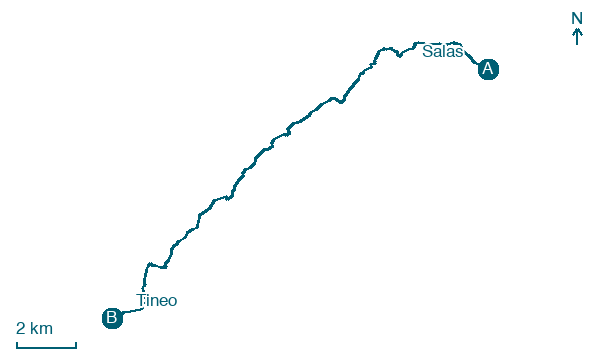
Salas → Tineo
Walking distance 19.5 km
Download Appy for the stage map
Stage information
- Ascent
- 723 m
- Descent
- 276 m
Difficulty: moderate
Walking the stage
Climb 723 m over 20 km from Salas to Tineo, passing La Peña, Porciles, La Espina and La Pereda.
Before leaving Salas, locate Museo prerrománico de San Martín de Salas on the map. It is close to the starting point.
Look for these places on the stage map: La Peñallonga, La Espina, La Pontiga, and Valdarieme.
What to see on this stage
History and landmarks
Museo prerrománico de San Martín de Salas
Museum · < 100 m from the trail as the crow flies
Preromanesque Museum of San Martín de Salas. 20th-century museum, in Salas, Spain.
Palace and Tower of Valdés Salas
< 100 m from the trail as the crow flies
Monument, in Salas, Spain, designated as part of UNESCO World Heritage Site.
Nature and landscape
Peñas Miro el Touro
Summit · 1,000 m from the trail as the crow flies
Pico el Viso
Summit · 1.6 km from the trail as the crow flies
Map · Salas → Tineo
Take your walk with you: download Appy
Camino Primitivo: Salas → Tineo. Explore maps, stages and elevation in the app, and plan your train or bus journey.

