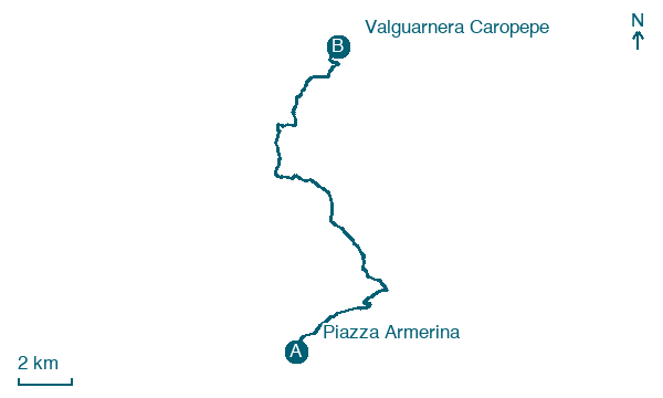
Piazza Armerina → Valguarnera Caropepe
Walking distance 19 km
Download Appy for the stage map
Stage information
- Ascent
- 278 m
- Descent
- 379 m
Difficulty: moderate
Walking the stage
Follow 19 km from Piazza Armerina to Valguarnera Caropepe, with some ups and downs adding 278 m of ascent.
What to see on this stage
History and landmarks
Torre Castellina
Tower · 1.1 km from the trail as the crow flies
Tower, in Piazza Armerina, Italy, designated as Italian national heritage.
Aragonese Castle
Castle · 1.7 km from the trail as the crow flies
A square fortress with corner towers on the southern slope of Colle Mira, in the old medieval quarter. It dates to the fourteenth century and was raised under King Martin, probably over an earlier Franciscan monastery.
Nature and landscape
Riserva naturale orientata Rossomanno-Grottascura-Bellia
National park · 200 m from the trail as the crow flies
A reserve of over 2,000 hectares in Sicily's Erei mountains, where sandy plateaus around 800 metres are covered in conifers from an old reforestation. The land was long inhabited, starting with the ancient centre of Rossomanno, destroyed in the 14th century.
Monte Rossomanno
Summit · 2 km from the trail as the crow flies
Map · Piazza Armerina → Valguarnera Caropepe
Take your walk with you: download Appy
Cammino di San Giacomo in Sicilia: Piazza Armerina → Valguarnera Caropepe. Explore maps, stages and elevation in the app, and plan your train or bus journey.

