Stia → Camaldoli
Walking distance 17.5 km
Download Appy for the stage map
Stage information
- Ascent
- 704 m
- Descent
- 296 m
Difficulty: moderate
Walking the stage
Walk 18 km from Stia to Camaldoli with a stiff 704 m climb, through Lonnano, Casalino and Valagnesi.
Before leaving Stia, locate Raccolta comunale d'arte contemporanea di Stia on the map. It is close to the starting point. On arrival in Camaldoli, consider a stop at Monastero di Camaldoli, close to the finish.
Look for these places on the stage map: Lonnano, Casalino, Moggiona, and Montanino.
What to see on this stage
History and landmarks
Raccolta comunale d'arte contemporanea di Stia
Museum · < 100 m from the trail as the crow flies
Monastero di Camaldoli
Monastery · < 100 m from the trail as the crow flies
Nature and landscape
Riserva naturale Camaldoli
National park · 800 m from the trail as the crow flies
Laghetto Traversari
Lake · 1.4 km from the trail as the crow flies
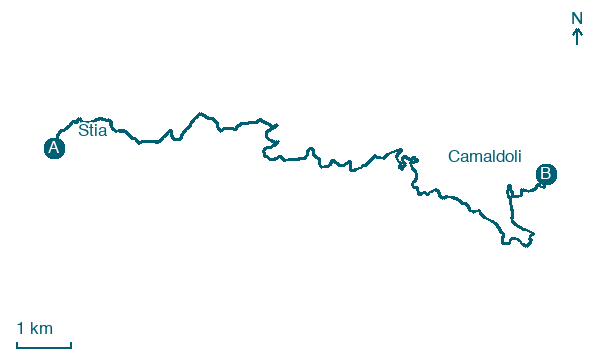
Map · Stia → Camaldoli
Take your walk with you: download Appy
Via di Francesco da Firenze a la Verna: Stia → Camaldoli. Explore maps, stages and elevation in the app, and plan your train or bus journey.

