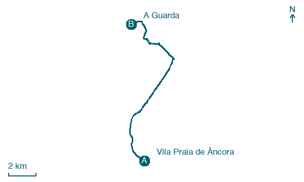
Vila Praia de Âncora → A Guarda
Walking distance 14.7 km
Download Appy for the stage map
Stage information
- Ascent
- 228 m
- Descent
- 207 m
Difficulty: easy (estimated)
Walking the stage
Take the 15 km from Vila Praia de Âncora to A Guarda, passing Moledo and Cristelo, with 228 m of ascent.
On arrival in A Guarda, consider a stop at Castro de Santa Trega, close to the finish.
Look for these places on the stage map: Moledo, Cristelo, O Palomar, and Sa.
What to see on this stage
History and landmarks
Castro de Santa Trega
500 m from the trail as the crow flies
Hillfort of the Castro culture at 341 metres, over the mouth of the River Miño, lived in from about 100 BC to 100 AD. Rocks on the hill carry petroglyphs made 2,000 years before the settlers.
Monte de Santa Trega
700 m from the trail as the crow flies
Natural landmark, in A Guarda, Spain, at 341 m elevation.
Nature and landscape
O Facho de Santa Trega
Summit · 700 m from the trail as the crow flies
Monte de Santa Trega
Summit · 800 m from the trail as the crow flies
Map · Vila Praia de Âncora → A Guarda
Take your walk with you: download Appy
Camino Portugues Coastal Litoral (Spain section): Vila Praia de Âncora → A Guarda. Explore maps, stages and elevation in the app, and plan your train or bus journey.

