Bomerano (Agerola) → Nocelle (Positano)
Walking distance 5.3 km
Download Appy for the stage map
Stage information
- Ascent
- 223 m
- Descent
- 407 m
Difficulty: easy
Walking the stage
The iconic Sentiero degli Dei trail along dramatic limestone cliffs high above the Amalfi Coast, with views of Capri, Li Galli islands, and the coastline from Positano to Praiano.
Before leaving Bomerano (Agerola), locate Bomerano on the map. It is close to the starting point.
Look for these places on the stage map: Praiano.
What to see on this stage
History and landmarks
Bomerano
100 m from the trail as the crow flies
This frazione of Agerola is where the Sentiero degli Dei begins: an old mule track that runs from Bomerano to Nocelle, the upper frazione of Positano. Free parking is near the main square.
Via Sentiero degli Dei
Bridge · < 100 m from the trail as the crow flies
Nature and landscape
Platano orientale di Piazza Unita' D'Italia, Agerola
Monumental tree · 1.2 km from the trail as the crow flies
Italy’s monumental tree register identifies this specimen as Platanus orientalis L. It records a height of 10 m and a trunk circumference of 300 cm.
Tiglio nostrale di Campora - Via Florio, Agerola
Monumental tree · 1.6 km from the trail as the crow flies
Italy’s monumental tree register identifies this specimen as Tilia platyphyllos Scop. It records a height of 30 m and a trunk circumference of 410 cm.
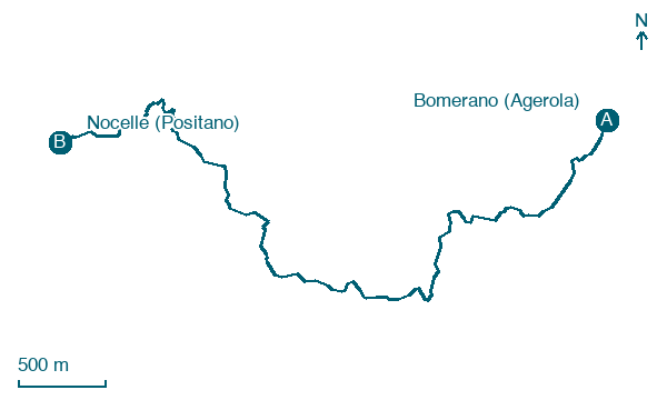
Map · Bomerano (Agerola) → Nocelle (Positano)
Take your walk with you: download Appy
Sentiero degli Dei: Bomerano (Agerola) → Nocelle (Positano). Explore maps, stages and elevation in the app, and plan your train or bus journey.

