Birzai → Pajiesmeniai
Walking distance 32.5 km
Download Appy for the stage map
Stage information
- Ascent
- 9 m
- Descent
- 19 m
Difficulty: moderate
Walking the stage
Stage 3: Birzai → Pajiesmeniai, 32.5 km
Before leaving Birzai, locate Church of St. John the Baptist, Biržai on the map. It is close to the starting point.
Look for these places on the stage map: Latveliškis, Gerkiškiai, Balčiūniškis, and Raubonys.
What to see on this stage
History and landmarks
Biržai Castle
Castle · 200 m from the trail as the crow flies
A Renaissance castle, partly Baroque, begun in 1586 by Krzysztof Mikołaj Radziwiłł beside Lake Širvėna, which a dam created. Rebuilt from ruins in the 1980s, it holds a library and a regional history museum.
Church of St. John the Baptist, Biržai
Church · < 100 m from the trail as the crow flies
Church, dedicated to John the Baptist, in Biržai, Lithuania.
Nature and landscape
Širvėnos ežeras
Lake · 900 m from the trail as the crow flies
Lake, in Biržai District Municipality, Lithuania, at 62 m elevation.
Mintagailiškių Lake
Lake · 100 m from the trail as the crow flies
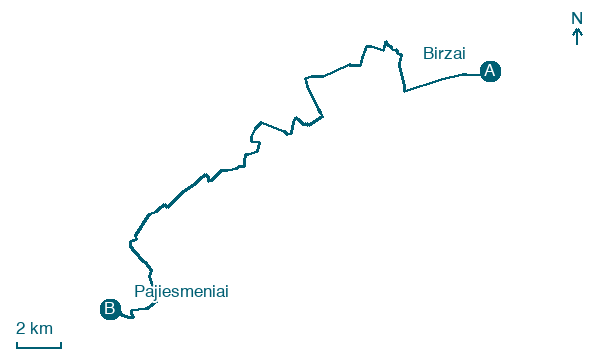
Map · Birzai → Pajiesmeniai
Take your walk with you: download Appy
Cammino Lituano di San Giacomo: Birzai → Pajiesmeniai. Explore maps, stages and elevation in the app, and plan your train or bus journey.

