San Carlo → Camaiore
Walking distance 25.9 km
Download Appy for the stage map
Stage information
- Ascent
- 404 m
- Descent
- 433 m
Difficulty: moderate
Walking the stage
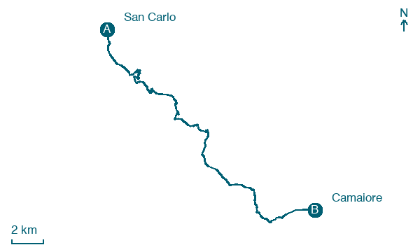
Walk 26 km from San Carlo to Camaiore, with 404 m of climbing along the way, passing through Debbia and Prato.
Before leaving San Carlo, locate Castello Malaspina on the map. It is close to the starting point. On arrival in Camaiore, consider a stop at Museo della Pietra Piegata, close to the finish.
Look for these places on the stage map: Debbia, Strettoia, Pietrasanta, and Campiglioni.
What to see on this stage
History and landmarks
Castello Malaspina
Castle · < 100 m from the trail as the crow flies
Castle, in Massa, Italy, designated as Italian national heritage.
Museo della Pietra Piegata
Museum · < 100 m from the trail as the crow flies
Museum of the Bent Stone. 21st-century museum, in Stazzema, Italy, designated as Italian national heritage.
Map · San Carlo → Camaiore
Take your walk with you: download Appy
Via Francigena: San Carlo → Camaiore. Explore maps, stages and elevation in the app, and plan your train or bus journey.

