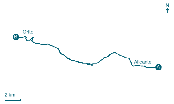
Alicante → Orito
Walking distance 23 km
Download Appy for the stage map
Stage information
- Ascent
- 555 m
- Descent
- 304 m
Difficulty: moderate (estimated)
Walking the stage
Leave Alicante for Orito, 23 km with 555 m of ascent, passing la Serreta and el Rebolledo.
Before leaving Alicante, locate Convent of the Capuchin Poor Clares on the map. It is close to the starting point.
Look for these places on the stage map: la Serreta, el Rebolledo, and l'Alcoraia.
What to see on this stage
History and landmarks
Convent of the Capuchin Poor Clares
Monastery · 400 m from the trail as the crow flies
Convent of the Capuchin Poor Clares, built with income granted by the city council, local townspeople, Prince John of Austria and King Charles II of Spain.
Hogueras museum
Museum · 400 m from the trail as the crow flies
Museum, in Alicante, Spain.
Nature and landscape
Alt de Fontcalent
Summit · 500 m from the trail as the crow flies
Alt de Sant Pascual
Summit · 900 m from the trail as the crow flies
Map · Alicante → Orito
Take your walk with you: download Appy
Camino de la Lana: Alicante → Orito. Explore maps, stages and elevation in the app, and plan your train or bus journey.

