Sferracavallo → Bolsena
Walking distance 24.8 km
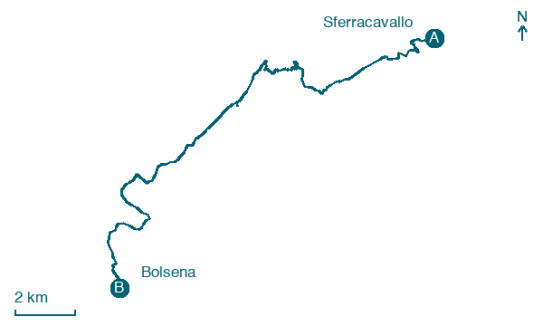
Download Appy for the stage map
Stage information
- Ascent
- 511 m
- Descent
- 481 m
Difficulty: moderate
Walking the stage
Follow 25 km from Sferracavallo to Bolsena via Tamburino and Trinità, with some ups and downs adding 511 m of ascent.
Before leaving Sferracavallo, locate Palazzo Coelli on the map. It is close to the starting point. On arrival in Bolsena, consider a stop at Castello di Bolsena, close to the finish.
Look for these places on the stage map: Tamburino, Trinità, Canonica, and Casa Perazza.
What to see on this stage
History and landmarks
Palazzo Coelli
Palace · < 100 m from the trail as the crow flies
Palace, in Orvieto, Italy, designated as Italian national heritage, covering 1000.0 km².
Castello di Bolsena
Castle · < 100 m from the trail as the crow flies
Medieval fortress raised in stages between the eleventh and fourteenth centuries, when the Guelf Monaldeschi family held the town. Inside is the museum of Lake Bolsena, with Villanovan, Etruscan and Roman finds.
Nature and landscape
Poggio del Torrone
Summit · 1 km from the trail as the crow flies
Peak, in Castel Giorgio, Italy, at 690 m elevation.
Grotte della Rupe
200 m from the trail as the crow flies
Map · Sferracavallo → Bolsena
Take your walk with you: download Appy
Cammino dell'intrepido Larth: Sferracavallo → Bolsena. Explore maps, stages and elevation in the app, and plan your train or bus journey.

