Logroño → Nájera
Walking distance 27.9 km
Download Appy for the stage map
Stage information
- Ascent
- 311 m
- Descent
- 204 m
Difficulty: challenging (estimated)
Walking the stage
Leave Logroño behind and walk 28 km via Navarrete, Ventosa and Alesón to Nájera, climbing 311 m.
Before leaving Logroño, locate Museo de La Rioja on the map. It is close to the starting point. On arrival in Nájera, consider a stop at Malpica, close to the finish.
Look for these places on the stage map: Navarrete, Sotés, Ventosa, and Alesón.
What to see on this stage
History and landmarks
Library of La Rioja, Exconvent of La Merced and Former Tobacco Factory of Logroño
< 100 m from the trail as the crow flies
Monument, in Logroño, Spain, designated as cultural heritage.
Museo de La Rioja
Museum · 100 m from the trail as the crow flies
Museum of La Rioja. 20th-century museum, in Logroño, Spain, designated as historic grouping.
Nature and landscape
Malpica
Summit · 400 m from the trail as the crow flies
Cerro de la Mota
Summit · 800 m from the trail as the crow flies
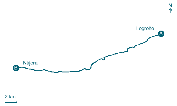
Map · Logroño → Nájera
Take your walk with you: download Appy
Camino Frances: Logroño → Nájera. Explore maps, stages and elevation in the app, and plan your train or bus journey.

