Firenze → Pontassieve
Walking distance 18.9 km
Download Appy for the stage map
Stage information
- Ascent
- 230 m
- Descent
- 174 m
Difficulty: moderate
Walking the stage
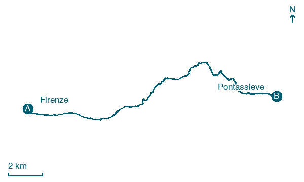
Walk 19 km from Firenze to Pontassieve, passing Nave a Rovezzano, San Jacopo al Girone and Vallina, with 230 m of climbing.
Before leaving Firenze, locate Palazzo Picchi già Gherardi on the map. It is close to the starting point.
Look for these places on the stage map: Nave a Rovezzano, Vallina, Le Sieci, and Rosano.
What to see on this stage
History and landmarks
Palazzo Picchi già Gherardi
Palace · 200 m from the trail as the crow flies
external and internal facades: painted plaster/ stone
Palazzo Borghese
Palace · 300 m from the trail as the crow flies
load-bearing walls: stone and brick (core)/ stone and marble (courses and decorations)
Nature and landscape
Robinia di Via dei Pepi 7, Firenze
Monumental tree · 100 m from the trail as the crow flies
Italy’s monumental tree register identifies this specimen as Robinia pseudoacacia L. It records a height of 18 m and a trunk circumference of 270 cm.
Bagolaro di Terenzano - Compiobbi - Via della Rosa 11-13, Fiesole
Monumental tree · 400 m from the trail as the crow flies
Italy’s monumental tree register identifies this specimen as Celtis australis L. It records a height of 15 m and a trunk circumference of 405 cm.
Map · Firenze → Pontassieve
Take your walk with you: download Appy
Via di Francesco da Firenze a la Verna: Firenze → Pontassieve. Explore maps, stages and elevation in the app, and plan your train or bus journey.

