Cervera → Tàrrega
Walking distance 15 km
Download Appy for the stage map
Stage information
- Ascent
- 52 m
- Descent
- 206 m
Difficulty: moderate (estimated)
Walking the stage
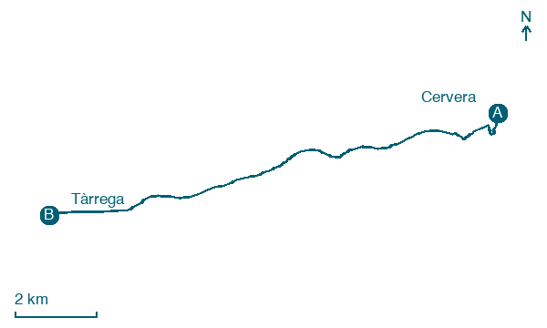
Follow 15 km from Cervera to Tàrrega via la Curullada and Fonolleres, on nearly flat ground with 52 m of ascent.
Before leaving Cervera, locate Font de Sant Agustí on the map. It is close to the starting point.
Look for these places on the stage map: la Curullada, Fonolleres, la Móra, and el Talladell.
What to see on this stage
History and landmarks
Casa consistorial de Cervera
< 100 m from the trail as the crow flies
Monument in baroque style, in Cervera, Spain, designated as cultural heritage, at 542 m elevation.
Font de Sant Agustí
< 100 m from the trail as the crow flies
18th-century fountain in vernacular style, in Cervera, Spain, designated as Cultural Asset of Local Interest, at 544 m elevation.
Nature and landscape
Tossal de les Tenalles
Summit · 400 m from the trail as the crow flies
Tossal del Trilla
Summit · 1.5 km from the trail as the crow flies
Map · Cervera → Tàrrega
Take your walk with you: download Appy
Camino Catalan: Cervera → Tàrrega. Explore maps, stages and elevation in the app, and plan your train or bus journey.

