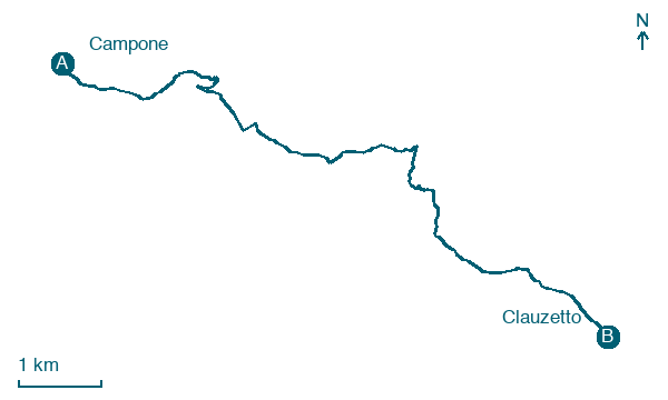
Campone → Clauzetto
Walking distance 9.9 km
Download Appy for the stage map
Stage information
- Ascent
- 464 m
- Descent
- 320 m
Difficulty: moderate
Walking the stage
Follow 10 km from Campone to Clauzetto via Gerchia / Gjercje and Zuanes, with some ups and downs adding 464 m of ascent.
On arrival in Clauzetto, consider a stop at chiesa di San Paolo Apostolo, close to the finish.
Look for these places on the stage map: Gerchia / Gjercje and Zuanes.
What to see on this stage
History and landmarks
Grotta del Rio Secco
Archaeological site · 400 m from the trail as the crow flies
chiesa di San Paolo Apostolo
Church · 100 m from the trail as the crow flies
Nature and landscape
Grotte verdi di Pradis
< 100 m from the trail as the crow flies
Castagno di Corgnal, Clauzetto
Monumental tree · 300 m from the trail as the crow flies
Italy’s monumental tree register identifies this specimen as Castanea sativa Mill. It records a height of 20 m and a trunk circumference of 463 cm.
Map · Campone → Clauzetto
Take your walk with you: download Appy
Cammino di San Cristoforo Anello Val Meduna: Campone → Clauzetto. Explore maps, stages and elevation in the app, and plan your train or bus journey.

