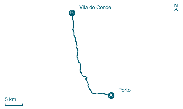
Porto → Vila do Conde
Walking distance 33.7 km
Download Appy for the stage map
Stage information
- Ascent
- 421 m
- Descent
- 476 m
Difficulty: challenging (estimated)
Walking the stage
Leave Porto for Vila do Conde, 34 km with 421 m of ascent, passing Matosinhos and Labruge.
Before leaving Porto, locate Casa da Câmara on the map. It is close to the starting point.
Look for these places on the stage map: Lugar do Castelo, Perafita, Vila Chã, and Azurara.
What to see on this stage
History and landmarks
Tower of D. Pedro Pitões
Tower · < 100 m from the trail as the crow flies
Casa da Câmara
Museum · < 100 m from the trail as the crow flies
Nature and landscape
Praia de Angeiras Norte
Beach · < 100 m from the trail as the crow flies
Praia do Puço
Beach · < 100 m from the trail as the crow flies
Map · Porto → Vila do Conde
Take your walk with you: download Appy
Camino Portugues Coastal Litoral (Spain section): Porto → Vila do Conde. Explore maps, stages and elevation in the app, and plan your train or bus journey.

