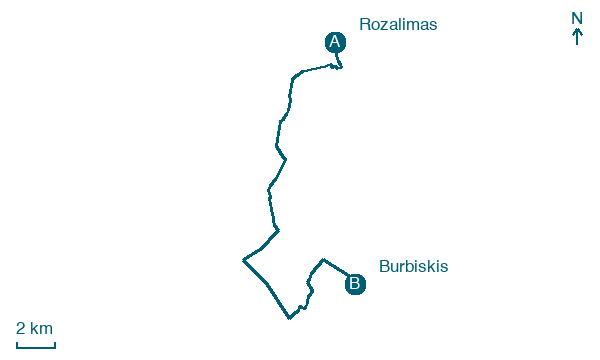
Rozalimas → Burbiskis
Walking distance 24.7 km
Download Appy for the stage map
Stage information
- Ascent
- 0 m
- Descent
- 8 m
Difficulty: easy
Walking the stage
Stage 8: Rozalimas → Burbiskis, about 25 km
Before leaving Rozalimas, locate Church of the Holy Name of the Virgin Mary, Rozalimas on the map. It is close to the starting point.
Look for these places on the stage map: Rokoniai, Mediniškiai, Karizniškis, and Tankūnai.
What to see on this stage
History and landmarks
Church of the Holy Name of the Virgin Mary, Rozalimas
Church · < 100 m from the trail as the crow flies
Church, dedicated to Mary, in Rozalimas, Lithuania.
Jomantoniai
< 100 m from the trail as the crow flies
Nature and landscape
Daugyvenė Landscape Reserve
National park · < 100 m from the trail as the crow flies
Rozalimo tvenkinys
Lake · 100 m from the trail as the crow flies
Map · Rozalimas → Burbiskis
Take your walk with you: download Appy
Cammino Lituano di San Giacomo: Rozalimas → Burbiskis. Explore maps, stages and elevation in the app, and plan your train or bus journey.

