O Cádavo → Lugo
Walking distance 31.1 km
Download Appy for the stage map
Stage information
- Ascent
- 374 m
- Descent
- 628 m
Difficulty: moderate
Walking the stage
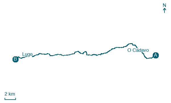
Cover 31 km from O Cádavo to Lugo, passing Vilabade, Tarrío and Souto de Torres, with 374 m of ascent.
On arrival in Lugo, consider a stop at Museo Provincial de Lugo, close to the finish.
Look for these places on the stage map: Pradeda, San Miguel, Bascuas, and O Carqueixo.
What to see on this stage
History and landmarks
Museo Provincial de Lugo
400 m from the trail as the crow flies
20th-century monument, in Lugo city, Spain, designated as bien de interés cultural.
University Museum A Domus do Mitreo
Archaeological site · 500 m from the trail as the crow flies
University museum beside Lugo's Roman wall, where digging for the building uncovered a Roman house later partly converted into a private mithraeum. The plans were redrawn to keep it, and the excavated remains can be seen on the basement floor.
Nature and landscape
Alto do Monte da Lomba
Summit · 200 m from the trail as the crow flies
Monte do Castelo
Summit · 500 m from the trail as the crow flies
Map · O Cádavo → Lugo
Take your walk with you: download Appy
Camino Primitivo: O Cádavo → Lugo. Explore maps, stages and elevation in the app, and plan your train or bus journey.

