Allande → La Mesa
Walking distance 21.6 km
Download Appy for the stage map
Stage information
- Ascent
- 843 m
- Descent
- 534 m
Difficulty: moderate
Walking the stage
Climb 843 m over 22 km from Allande to La Mesa, passing Colobréu, La Reigada and Montefurado.
Look for these places on the stage map: Colobréu, La Reigada, Lago, and Berducedo.
What to see on this stage
History and landmarks
Nature and landscape
Pico Lago
Summit · 300 m from the trail as the crow flies
Pico del Palo
Summit · 500 m from the trail as the crow flies
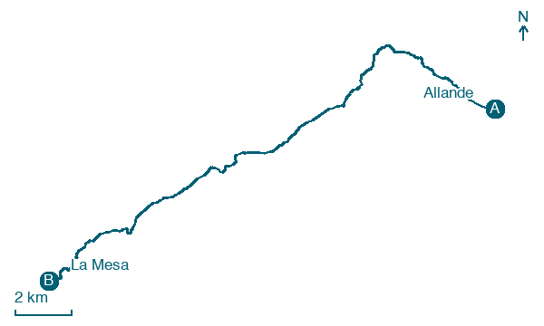
Map · Allande → La Mesa
Take your walk with you: download Appy
Camino Primitivo: Allande → La Mesa. Explore maps, stages and elevation in the app, and plan your train or bus journey.

