San Gimignano-Monteriggioni → Monteriggioni-Siena
Walking distance 30.5 km
Download Appy for the stage map
Stage information
- Ascent
- 899 m
- Descent
- 976 m
Difficulty: challenging
Walking the stage
Walk 30 km from San Gimignano-Monteriggioni to Monteriggioni-Siena with 899 m of climbing, passing Strove and Castellina Scalo.
Before leaving San Gimignano-Monteriggioni, locate TORRE DEGLI ARDINGHELLI on the map. It is close to the starting point. On arrival in Monteriggioni-Siena, consider a stop at Monteriggioni Museum, close to the finish.
Look for these places on the stage map: Strove, Castellina Scalo, and Monteriggioni.
What to see on this stage
History and landmarks
TORRE DEGLI ARDINGHELLI
Tower · < 100 m from the trail as the crow flies
Buildings with a trapezoidal plan; vertical structures in brick and stone; flat roof.
Monteriggioni Museum
Museum · < 100 m from the trail as the crow flies
21st-century museum, in Monteriggioni, Italy, designated as Italian national heritage, covering 200.0 km².
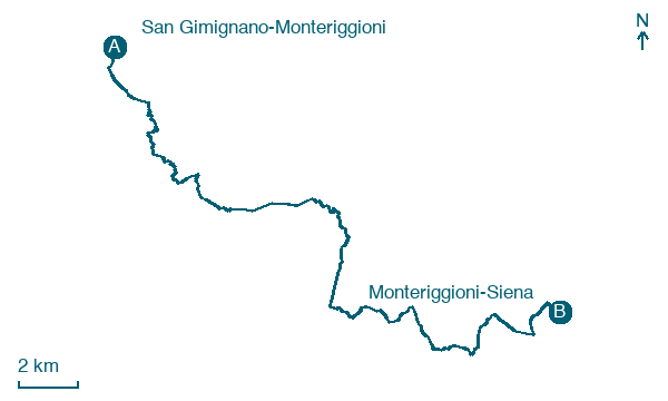
Map · San Gimignano-Monteriggioni → Monteriggioni-Siena
Take your walk with you: download Appy
Romea Tuscia: San Gimignano-Monteriggioni → Monteriggioni-Siena. Explore maps, stages and elevation in the app, and plan your train or bus journey.

