Barbarano Romano → Blera
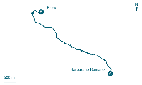
Walking distance 8.5 km
Download Appy for the stage map
Stage information
- Ascent
- 234 m
- Descent
- 287 m
Difficulty: easy
Walking the stage
Follow 8 km from Barbarano Romano to Blera via Bandita, with some ups and downs adding 234 m of ascent.
Before leaving Barbarano Romano, locate Crocifisso Church on the map. It is close to the starting point. On arrival in Blera, consider a stop at Santa Maria del Suffragio, close to the finish.
Look for these places on the stage map: Bandita.
What to see on this stage
History and landmarks
Santa Maria del Suffragio
Church · < 100 m from the trail as the crow flies
Church, dedicated to Mary, in Blera, Italy.
Crocifisso Church
Church · < 100 m from the trail as the crow flies
Church, in Barbarano Romano, Italy, designated as Italian national heritage.
Nature and landscape
Parco regionale Marturanum
National park · 1.4 km from the trail as the crow flies
Frassino meridionale di Fontanile di Trocchi, Blera
Monumental tree · 1.8 km from the trail as the crow flies
Italy’s monumental tree register identifies this specimen as Fraxinus angustifolia Vahl subsp. oxycarpa (Willd.) Franco & Rocha Afonso. It records a height of 21.4 m and a trunk circumference of 273 cm.
Map · Barbarano Romano → Blera
Take your walk with you: download Appy
Cammino dei Tre Villaggi: Barbarano Romano → Blera. Explore maps, stages and elevation in the app, and plan your train or bus journey.

