Castel di Tusa → Tusa
Walking distance 4.9 km
Download Appy for the stage map
Stage information
- Ascent
- 550 m
- Descent
- 76 m
Difficulty: moderate
Walking the stage
Walk 5 km from Castel di Tusa to Tusa, a short day with 550 m of climbing, so take it slowly.
Before leaving Castel di Tusa, locate Castel di Tusa on the map. It is close to the starting point. On arrival in Tusa, consider a stop at Halaesa, close to the finish.
What to see on this stage
History and landmarks
Castel di Tusa
Castle · 300 m from the trail as the crow flies
Castle, in Tusa, Italy, designated as Italian national heritage.
Halaesa
Archaeological site · 600 m from the trail as the crow flies
Ruins of an ancient Siculo-Greek city founded in 403 BC, according to Diodorus. Its coins carried a column topped by a dog, a symbol that still appears in the coat of arms of Tusa.
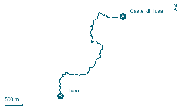
Map · Castel di Tusa → Tusa
Take your walk with you: download Appy
Cammino di San Felice da Nicosia: Castel di Tusa → Tusa. Explore maps, stages and elevation in the app, and plan your train or bus journey.

