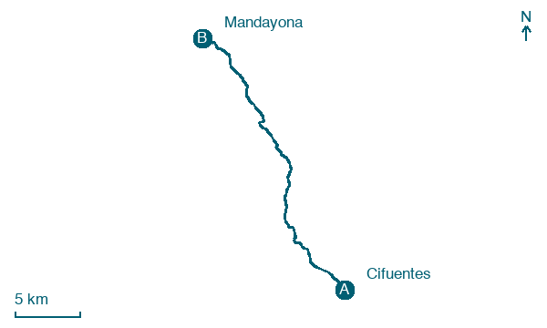
Cifuentes → Mandayona
Walking distance 25.7 km
Download Appy for the stage map
Stage information
- Ascent
- 420 m
- Descent
- 441 m
Difficulty: challenging (estimated)
Walking the stage
Head from Cifuentes to Mandayona, 26 km and 420 m of ascent, through Moranchel and Masegoso de Tajuña.
Before leaving Cifuentes, locate Monasterio de San Blas, Cifuentes on the map. It is close to the starting point.
Look for these places on the stage map: Moranchel, Masegoso de Tajuña, Las Inviernas, and Mirabueno.
What to see on this stage
History and landmarks
Monasterio de San Blas, Cifuentes
Monastery · < 100 m from the trail as the crow flies
17th-century monastery, in Cifuentes, Spain.
Castillo de Don Juan Manuel, Cifuentes
Castle · 300 m from the trail as the crow flies
Castle, in Cifuentes, Spain, designated as bien de interés cultural.
Nature and landscape
Manantial del Majuelo del Fraile
400 m from the trail as the crow flies
Manantial de la Sabina
1.3 km from the trail as the crow flies
Map · Cifuentes → Mandayona
Take your walk with you: download Appy
Camino de la Lana: Cifuentes → Mandayona. Explore maps, stages and elevation in the app, and plan your train or bus journey.

