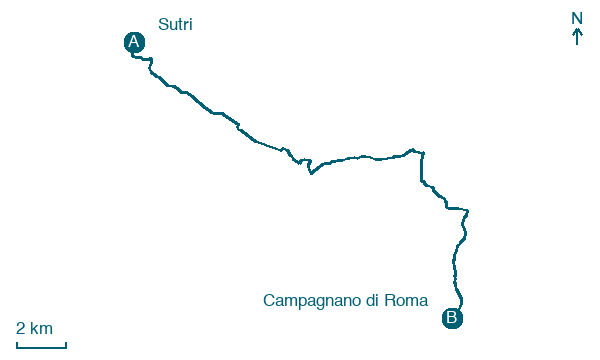
Sutri → Campagnano di Roma
Walking distance 23.8 km
Download Appy for the stage map
Stage information
- Ascent
- 193 m
- Descent
- 179 m
Difficulty: moderate
Walking the stage
Follow a 24 km stage from Sutri to Campagnano di Roma, with 193 m of climbing on the way, passing through Valdiano and Santa Maria-Le Vigne.
On arrival in Campagnano di Roma, consider a stop at San Giovanni Battista, close to the finish.
Look for these places on the stage map: Valdiano, Santa Maria-Le Vigne, Vigne Nuove, and Grezzano-Pian delle Rose.
What to see on this stage
History and landmarks
San Giovanni Battista
Church · < 100 m from the trail as the crow flies
Church in baroque style, dedicated to John the Baptist, in Campagnano di Roma, Italy, designated as Italian national heritage.
Mola di Monte Gelato
Archaeological site · < 100 m from the trail as the crow flies
Nature and landscape
Cascate di Monte Gelato
Waterfall · < 100 m from the trail as the crow flies
Lake Monterosi
Lake · 600 m from the trail as the crow flies
Map · Sutri → Campagnano di Roma
Take your walk with you: download Appy
Via Francigena: Sutri → Campagnano di Roma. Explore maps, stages and elevation in the app, and plan your train or bus journey.

