León → La Robla
Walking distance 26.5 km
Download Appy for the stage map
Stage information
- Ascent
- 341 m
- Descent
- 227 m
Difficulty: challenging (estimated)
Walking the stage
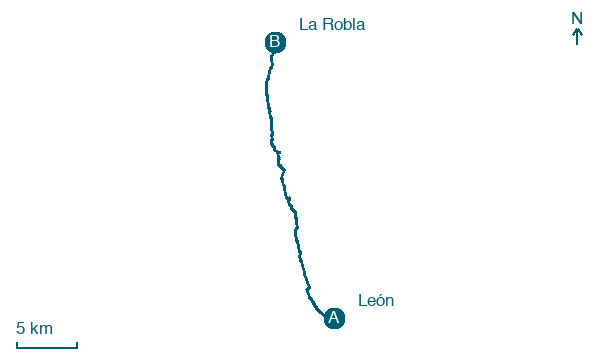
Leave León for La Robla, 26 km with 341 m of ascent, passing Villabalter and Carbajal de la Legua.
Before leaving León, locate Fuente de San Isidoro on the map. It is close to the starting point.
Look for these places on the stage map: Villabalter, Carbajal de la Legua, Cabanillas, and Cascantes de Alba.
What to see on this stage
History and landmarks
Fuente de San Isidoro
< 100 m from the trail as the crow flies
A fountain of 1787 from the reign of Charles III: a big rusticated pillar topped by a lion holding a column and a shield with Roman standards, recalling the city's Roman founding. Two masks pour the water, Medusa and a theatre mask.
Convent of San Marcos
Monastery · < 100 m from the trail as the crow flies
Renaissance monastery with a highly ornamental plateresque facade, begun as a twelfth-century shelter for travellers on the Camino de Santiago and home of the Order of Santiago. Now a parador hotel with church and museum, it held up to 7,000 prisoners in 1936-1940.
Map · León → La Robla
Take your walk with you: download Appy
Camino de San Salvador: León → La Robla. Explore maps, stages and elevation in the app, and plan your train or bus journey.

