Monteriggioni → Siena
Walking distance 20.6 km
Download Appy for the stage map
Stage information
- Ascent
- 317 m
- Descent
- 240 m
Difficulty: moderate
Walking the stage
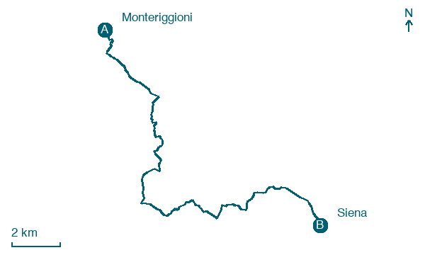
Follow a 21 km stage from Monteriggioni to Siena, with 317 m of climbing on the way, passing through Stomennano and Colli.
Before leaving Monteriggioni, locate Monteriggioni Museum on the map. It is close to the starting point. On arrival in Siena, consider a stop at Palazzo Sansedoni, Siena, close to the finish.
Look for these places on the stage map: Stomennano, Colle Ciupi, Pastine di Sotto, and Convento Vecchio.
What to see on this stage
History and landmarks
Monteriggioni Museum
Museum · < 100 m from the trail as the crow flies
21st-century museum, in Monteriggioni, Italy, designated as Italian national heritage, covering 200.0 km².
Palazzo Sansedoni, Siena
Palace · < 100 m from the trail as the crow flies
Palace, dedicated to Sansedoni, designed by Agostino da Siena, in Siena, Italy.
Nature and landscape
Riserva naturale Montecellesi
National park · 1.4 km from the trail as the crow flies
Map · Monteriggioni → Siena
Take your walk with you: download Appy
Via Francigena: Monteriggioni → Siena. Explore maps, stages and elevation in the app, and plan your train or bus journey.

