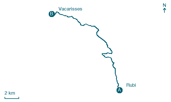
Rubí → Vacarisses
Walking distance 20.5 km
Download Appy for the stage map
Stage information
- Ascent
- 522 m
- Descent
- 334 m
Difficulty: moderate
Walking the stage
Follow 20 km from Rubí to Vacarisses through Terrassa and la Tendera, climbing 522 m on the way.
Before leaving Rubí, locate Castell de Rubí on the map. It is close to the starting point.
Look for these places on the stage map: Terrassa and la Tendera.
What to see on this stage
History and landmarks
Rubí Municipal Museum
Museum · < 100 m from the trail as the crow flies
Museum inside Rubí Castle, which served from the 13th to the 20th century as a defensive point, manor house and farmhouse. Its permanent show walks through the city's history from 300,000 BC, with Iberian, Roman and Civil War pieces.
Castell de Rubí
Castle · < 100 m from the trail as the crow flies
Castle in Gothic style, in Rubí, Spain, designated as Cultural Asset of National Interest.
Nature and landscape
Turó dels Escorpins
Summit · 1.1 km from the trail as the crow flies
Peak, in Terrassa, Spain, at 509 m elevation, built in slate.
Map · Rubí → Vacarisses
Take your walk with you: download Appy
Montserrat Monastery Pilgrim Routes: Rubí → Vacarisses. Explore maps, stages and elevation in the app, and plan your train or bus journey.

