Manresa → Igualada
Walking distance 30 km
Download Appy for the stage map
Stage information
- Ascent
- 257 m
- Descent
- 552 m
Difficulty: challenging (estimated)
Walking the stage
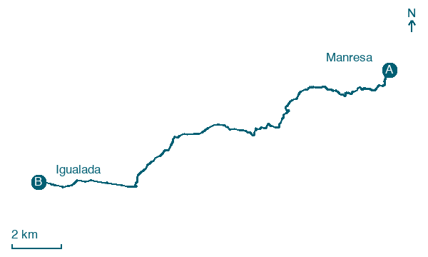
Start from Manresa and cover 30 km to Igualada via Castellolí and Vilanova del Camí, with 257 m of ascent.
On arrival in Igualada, consider a stop at Portal de la Font Major, close to the finish.
Look for these places on the stage map: Sant Pau de la Guàrdia, Castellolí, Clot de la Bleda, and Vilanova del Camí.
What to see on this stage
History and landmarks
Font de Neptú
< 100 m from the trail as the crow flies
A monument fountain inaugurated on 11 June 1832 to mark the arrival of water from the Espelt, topped by a crowned Neptune. Girls dance with pitchers around its Doric column, a sign of civic joy; the sculpture is by Damià Campeny.
Portal de la Font Major
< 100 m from the trail as the crow flies
Historic gate in Gothic style, in Igualada, Spain.
Nature and landscape
El Catarro
Summit · 600 m from the trail as the crow flies
Puig d'Aguilera
Summit · 1.5 km from the trail as the crow flies
Map · Manresa → Igualada
Take your walk with you: download Appy
Camino Catalan: Manresa → Igualada. Explore maps, stages and elevation in the app, and plan your train or bus journey.

