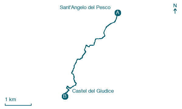
Sant'Angelo del Pesco → Castel del Giudice
Walking distance 4.9 km
Download Appy for the stage map
Stage information
- Ascent
- 71 m
- Descent
- 80 m
Difficulty: easy
Walking the stage
Cover 5 km from Sant'Angelo del Pesco to Castel del Giudice on gentle ground, with just 71 m of climbing overall.
On arrival in Castel del Giudice, consider a stop at Palazzo plurifamiliare e Torre dell'Orologio, close to the finish.
Look for these places on the stage map: Castelnuovo, Sant'Onofrio (Secondo), Macchia (seconda), and Capracotta.
What to see on this stage
History and landmarks
Palazzo Gentile-Mosesso
Palace · < 100 m from the trail as the crow flies
Palazzo plurifamiliare e Torre dell'Orologio
Tower · < 100 m from the trail as the crow flies
Nature and landscape
Cerro di Vigne, Castel del Giudice
Monumental tree · < 100 m from the trail as the crow flies
Italy’s monumental tree register identifies this specimen as Quercus cerris L. It records a height of 26 m and a trunk circumference of 391 cm.
Cerro di Strada Istonio-Sangrina Pressi Madonna in Saletta, Castel del Giudice
Monumental tree · 100 m from the trail as the crow flies
Italy’s monumental tree register identifies this specimen as Quercus cerris L. It records a height of 23 m and a trunk circumference of 380 cm.
Map · Sant'Angelo del Pesco → Castel del Giudice
Take your walk with you: download Appy
Cammino delle Chiese campestri: Sant'Angelo del Pesco → Castel del Giudice. Explore maps, stages and elevation in the app, and plan your train or bus journey.

