Citta di Castello → Pietralunga
Walking distance 29.5 km
Download Appy for the stage mapStage information
- Ascent
- 683 m
- Descent
- 472 m
Difficulty: moderate
Walking the stage
Climb from Citta di Castello to Pietralunga over 30 km, gaining 683 m, through Terme di Fontecchio, Mulino del Sasso and Sasso.
Before leaving Citta di Castello, locate Cattedrale di San Florido e Amanzio on the map. It is close to the starting point.
Look for these places on the stage map: Terme di Fontecchio, Sasso, Canocchia, and Pieve dei Saddi.
What to see on this stage
History and landmarks
Palazzo Vitelli in Piazza
Palace · < 100 m from the trail as the crow flies
Cattedrale di San Florido e Amanzio
Cathedral · < 100 m from the trail as the crow flies
Nature and landscape
Ippocastano di Piazza Gabriotti, Città di Castello
Monumental tree · < 100 m from the trail as the crow flies
Italy’s monumental tree register identifies this specimen as Aesculus hippocastanum L. It records a height of 20 m and a trunk circumference of 404 cm.
Roverella di Via Meltina 2, Città di Castello
Monumental tree · 500 m from the trail as the crow flies
Italy’s monumental tree register identifies this specimen as Quercus pubescens Willd. It records a height of 17.5 m and a trunk circumference of 345 cm.
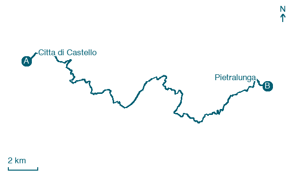
Map · Citta di Castello → Pietralunga
Take your walk with you: download Appy
Via di Francesco da la Verna Ad Assisi: Citta di Castello → Pietralunga. Explore maps, stages and elevation in the app, and plan your train or bus journey.

