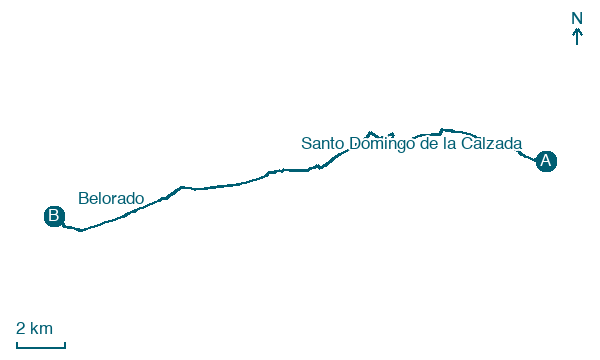
Santo Domingo de la Calzada → Belorado
Walking distance 22.3 km
Download Appy for the stage map
Stage information
- Ascent
- 247 m
- Descent
- 112 m
Difficulty: moderate (estimated)
Walking the stage
Go through Grañón, Redecilla del Camino and Viloria de Rioja for 22 km to Belorado, with 247 m of climbing.
Before leaving Santo Domingo de la Calzada, locate Abadía de Nuestra Señora de la Anunciación on the map. It is close to the starting point.
Look for these places on the stage map: Corporales, Redecilla del Camino, Viloria de Rioja, and Villamayor del Río.
What to see on this stage
History and landmarks
Puente de Santo Domingo de la Calzada
Bridge · < 100 m from the trail as the crow flies
Bridge of Santo Domingo de la Calzada. Bridge, in Santo Domingo de la Calzada, Spain, designated as part of UNESCO World Heritage Site.
Abadía de Nuestra Señora de la Anunciación
Abbey · < 100 m from the trail as the crow flies
Convent of Cistercian nuns, still a working community. It runs a hostel reserved for walkers with a credencial, and the nuns sell sweets to support the church and the community.
Nature and landscape
Cerro Mirabel
Summit · 1.1 km from the trail as the crow flies
Map · Santo Domingo de la Calzada → Belorado
Take your walk with you: download Appy
Camino Frances: Santo Domingo de la Calzada → Belorado. Explore maps, stages and elevation in the app, and plan your train or bus journey.

