Malinska → Omišalj
Walking distance 19.6 km
Download Appy for the stage map
Stage information
- Ascent
- 214 m
- Descent
- 129 m
Difficulty: moderate
Walking the stage
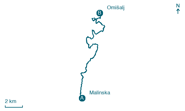
Head north from Malinska past Njivice and the iconic Krk Bridge to reach the hilltop town of Omišalj, perched above the sea on the island's northern tip with panoramic views of the Kvarner Bay.
Before leaving Malinska, locate Malinska on the map. It is close to the starting point. On arrival in Omišalj, consider a stop at Vele steni, close to the finish.
Look for these places on the stage map: Ribarsko selo, Njivice, Kanćinar, and Bajeć.
What to see on this stage
History and landmarks
Omišalj
100 m from the trail as the crow flies
Malinska
200 m from the trail as the crow flies
Nature and landscape
Vele steni
100 m from the trail as the crow flies
Map · Malinska → Omišalj
Take your walk with you: download Appy
Camino Krk: Malinska → Omišalj. Explore maps, stages and elevation in the app, and plan your train or bus journey.

