Piacenza → Fiorenzuola d'Arda
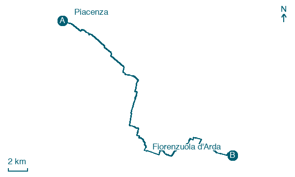
Walking distance 31.7 km
Download Appy for the stage map
Stage information
- Ascent
- 11 m
- Descent
- 7 m
Difficulty: moderate
Walking the stage
Cover 32 km from Piacenza to Fiorenzuola d'Arda on gentle ground, with just 11 m of climbing overall.
Before leaving Piacenza, locate Palazzo ex Conservatorio delle Putte on the map. It is close to the starting point.
Look for these places on the stage map: Croce Grossa, Valconasso, Chero, and La Felina.
What to see on this stage
History and landmarks
Palazzo ex Conservatorio delle Putte
Monastery · < 100 m from the trail as the crow flies
19th-century monastery, in Piacenza, Italy, designated as Italian national heritage.
Ex Convento di Sant'Anna
Monastery · < 100 m from the trail as the crow flies
18th-century monastery, in Piacenza, Italy, designated as Italian national heritage.
Nature and landscape
Platano comune di Palazzo Marazzini Visconti Terzi - Montanaro, San Giorgio Piacentino
Monumental tree · < 100 m from the trail as the crow flies
Italy’s monumental tree register identifies this specimen as Platanus acerifolia (Aiton) Willd. It records a height of 20 m and a trunk circumference of 545 cm.
Map · Piacenza → Fiorenzuola d'Arda
Take your walk with you: download Appy
Via Francigena: Piacenza → Fiorenzuola d'Arda. Explore maps, stages and elevation in the app, and plan your train or bus journey.

