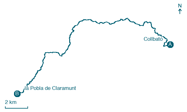
Collbató → la Pobla de Claramunt
Walking distance 21.9 km
Download Appy for the stage map
Stage information
- Ascent
- 724 m
- Descent
- 1162 m
Difficulty: moderate
Walking the stage
Head 22 km from Collbató to la Pobla de Claramunt through Castellolí and Sant Pau de la Guàrdia, with 724 m of ascent.
Look for these places on the stage map: la Colònia Puig, Santa Cecília, Castellolí, and els Masets.
What to see on this stage
History and landmarks
Turó del Castell de la Guàrdia
< 100 m from the trail as the crow flies
Natural landmark, in El Bruc, Spain, at 856 m elevation.
Roca Foradada (el Bruc)
< 100 m from the trail as the crow flies
Natural landmark, in El Bruc, Spain, at 928 m elevation, 10 m tall.
Nature and landscape
Turó de l'Ermità
Summit · 1.1 km from the trail as the crow flies
Peak, in Marganell, Spain, at 594 m elevation.
Turó de la Monja
Summit · < 100 m from the trail as the crow flies
Map · Collbató → la Pobla de Claramunt
Take your walk with you: download Appy
Montserrat Monastery Pilgrim Routes: Collbató → la Pobla de Claramunt. Explore maps, stages and elevation in the app, and plan your train or bus journey.

