Terenzo → Gravagna San Rocco
Walking distance 19.2 km
Download Appy for the stage map
Stage information
- Ascent
- 760 m
- Descent
- 491 m
Difficulty: moderate
Walking the stage
Tackle a demanding 19 km stage from Terenzo to Gravagna San Rocco, with 760 m of climbing on the way.
Before leaving Terenzo, locate Chiesa dell'Assunzione di Maria Vergine on the map. It is close to the starting point. On arrival in Gravagna San Rocco, consider a stop at Nostra Signora della Guardia, close to the finish.
Look for these places on the stage map: La colomba, Castellonchio, Tugo, and Vallingasco.
What to see on this stage
History and landmarks
Nostra Signora della Guardia
< 100 m from the trail as the crow flies
20th-century sanctuary in Romanesque Revival style, in Pontremoli, Italy, designated as Italian national heritage.
Chiesa dell'Assunzione di Maria Vergine
Church · 300 m from the trail as the crow flies
20th-century church in Romanesque style, dedicated to Assumption of Mary, in Terenzo, Italy, designated as Italian national heritage.
Nature and landscape
Monte Valoria
Summit · 600 m from the trail as the crow flies
Groppo del Vescovo
Summit · 1.2 km from the trail as the crow flies
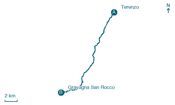
Map · Terenzo → Gravagna San Rocco
Take your walk with you: download Appy
Via Francigena: Terenzo → Gravagna San Rocco. Explore maps, stages and elevation in the app, and plan your train or bus journey.

