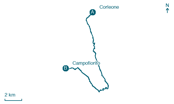
Corleone → Campofiorito
Walking distance 18.1 km
Download Appy for the stage map
Stage information
- Ascent
- 703 m
- Descent
- 583 m
Difficulty: moderate
Walking the stage
Climb from Corleone to Campofiorito over 18 km, gaining 703 m, a solid day on foot that rewards an early start.
Before leaving Corleone, locate Museo civico di Corleone on the map. It is close to the starting point.
What to see on this stage
History and landmarks
Museo civico di Corleone
Museum · 200 m from the trail as the crow flies
Civic Museum of Corleone. Museum, in Corleone, Italy, designated as Italian national heritage.
Corleone Castle
Castle · 300 m from the trail as the crow flies
Ruined castle on a rocky spur above the town: the walls have collapsed, but a round tower topped by a dry-stone dome still stands. A landslide in 1418 destroyed the San Giuliano quarter below and part of the castle.
Nature and landscape
Monte Barraù
Summit · 200 m from the trail as the crow flies
Gole del torrente Corleone
600 m from the trail as the crow flies
Map · Corleone → Campofiorito
Take your walk with you: download Appy
Sulle orme di San Bernardo – Cammini di fede, arte e natura: Corleone → Campofiorito. Explore maps, stages and elevation in the app, and plan your train or bus journey.

